

Statsraad Lehmkuhl is weather-bound in St. John’s, Newfoundland. The tropical cyclone Eirin has turned northward and is now sweeping past off the coast.
On Friday, August 22, the wind speed in Eirin reached 42 m/s. Hurricane force begins at 32 m/s, and under such conditions it is wise to remain sheltered in a safe harbor until the storm has passed.
– At the moment this will likely happen late on Saturday or early Sunday, just in time for us to be able to maintain our scheduled arrival in Bermuda, Marc Seidl writes in his captain's log on Thursday.

Full control
The ship’s satellite systems provide updated forecasts from maritime weather institutes every six hours. In addition, the crew downloads weather models that allow the navigator to predict wind strength and direction along the planned route.

On Friday, Eirin’s center was roughly level with Washington DC. In the coming days, the hurricane is expected to continue northeast along the coasts of the USA and Canada, before weakening into a low-pressure system between Greenland and Scotland late next week.
By then, Statsraad Lehmkuhl will have reached Bermuda, after what will likely be a rough passage in rain and heavy seas. For now, though, life on board remains calm.
– In the meantime, we will use the extra time in port to carry out many of the tasks we would not have had the opportunity to do while the ship is underway, be it technical maintenance, rigging work and cleaning and stowing away equipment that is no longer in use, Marc writes from port in St. John’s.

The most violent storms
Tropical cyclones are the most violent storms on Earth. Winds can exceed 80 m/s, and nearly a meter of rain may fall in just 24 hours. The winds generate massive waves, which, together with the low pressure, can cause storm surges and flooding.
Eirin is the first major hurricane in the Atlantic this season. What began as a low-pressure system developed into a tropical cyclone on August 11 over Cape Verde, off the coast of West Africa. In the days that followed, the storm crossed the Atlantic, and as it neared the Caribbean the wind intensified rapidly. On August 16, Eirin was classified as a Category 5 hurricane, with winds of 72 m/s.

So far, rainfall has caused the greatest damage. Within a few hours, 192 mm fell over São Vicente in Cape Verde August 11, where floodwaters swept away cars and destroyed several houses. Nine people lost their lives. In the Caribbean and the USA, fortunately no lives have been lost, though many have experienced power outages and evacuations due to flooding and storm surge.
Begins to rotate
Tropical cyclones form when warm, moist air over the ocean begins to rise. As the air cools with altitude, it can no longer hold its moisture, and raindrops form. This process releases heat, which makes the air rise even further.

At the same time, air masses begin to rotate around the center of the system, which is why these storms are called “cyclones.” Sometimes an “eye” forms in the center, where cold, dry air from high in the atmosphere descends and clears away the clouds. In a perfect cyclone, the eye is completely cloudless. New moist air is drawn in from the sides, rises, condenses into rain, and releases even more energy.
It is estimated that a tropical cyclone produces 200 times more energy than all of the world’s power plants combined.
Warm seas required
Tropical cyclones can only form when the ocean temperature is above 26.5 °C down to at least 50 meters. They also depend on the Earth’s rotation to make winds spiral toward the low-pressure center.
For this reason, most tropical cyclones form between 10 and 30 degrees north or south of the equator. Exactly at the equator, rotation does not occur.

Climate change, with both land and sea becoming warmer, also has consequences for tropical cyclones. They are becoming more powerful, intensifying more quickly, and carrying more rainfall - which, combined with rising sea levels, leads to greater damage from flooding and storm surges.
Typhoon or hurricane?
When wind speeds exceed 33 m/s, hurricane strength, tropical cyclones are divided into five categories. Category 5 is reserved for “super hurricanes,” with winds above 70 m/s - 250 km/h.
In the Atlantic and the eastern Pacific they are called "hurricanes". In the northwestern Pacific they are called "typhoons", which means “great wind” in Chinese.
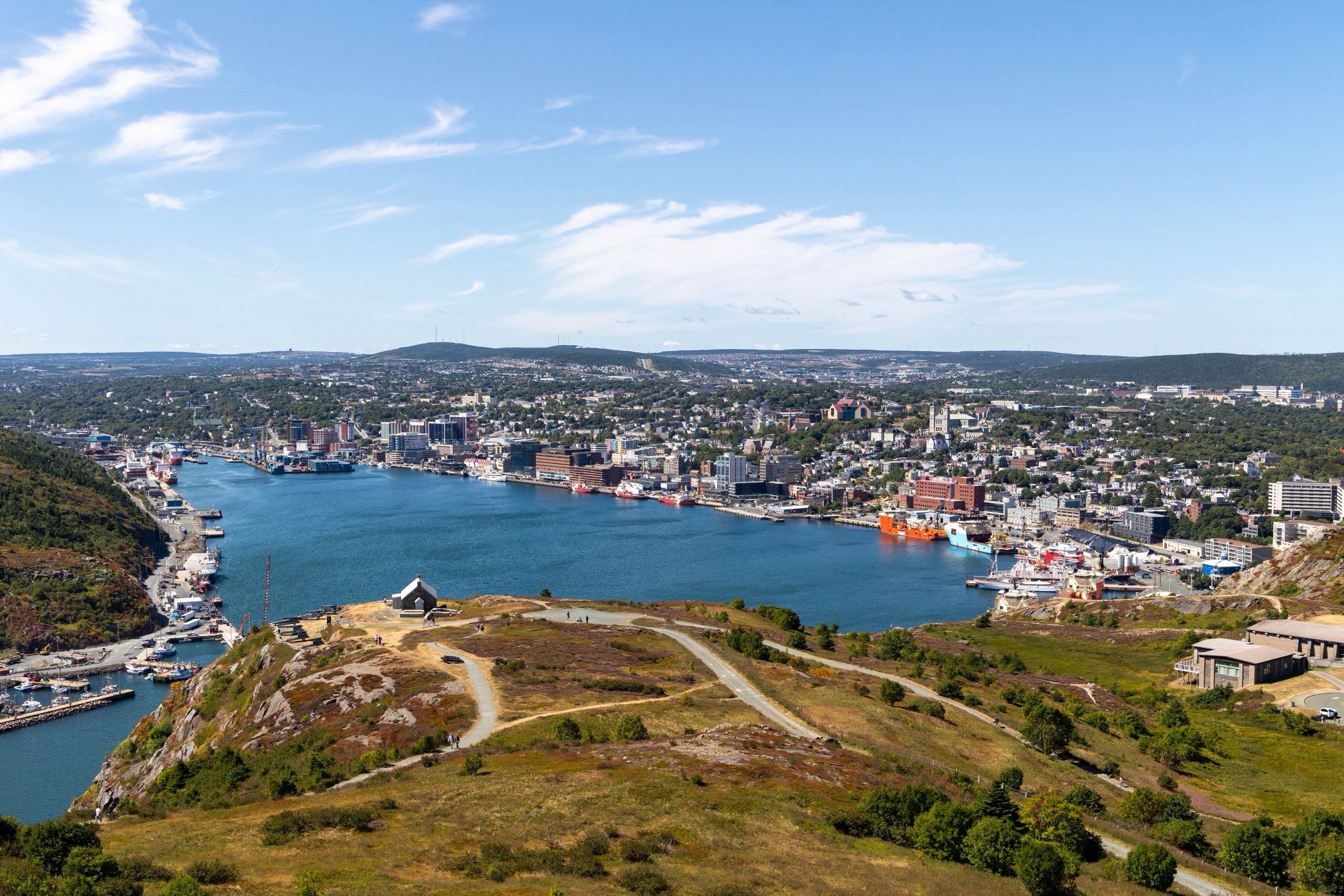
Moored in St. John's. The ship is to the right in the harbour. Photo: André Marton Pedersen
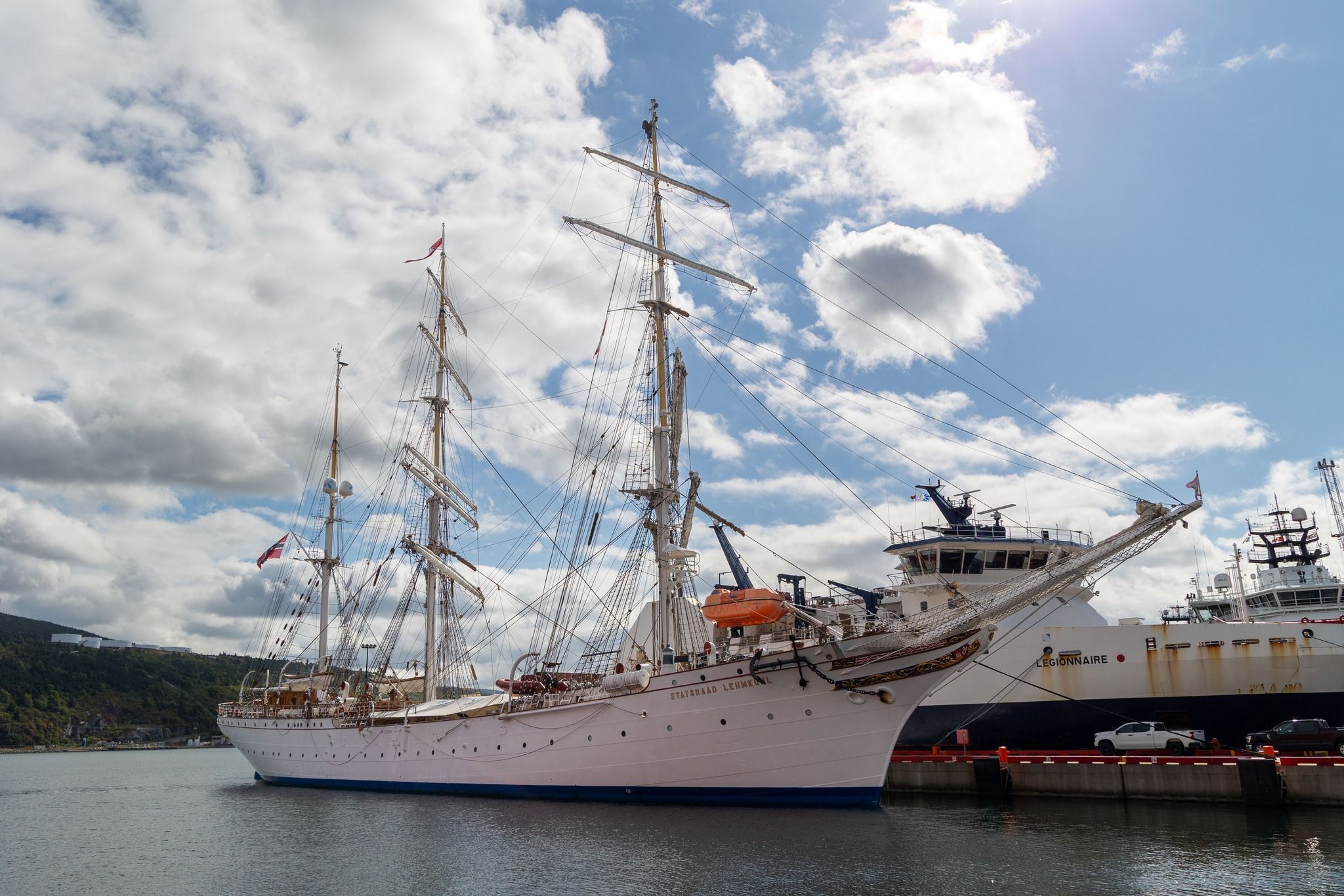
Moored in St. John's. Photo: André Marton Pedersen