

Measurements collected in the 1870s are still part of the time series used to track ocean temperature changes. But can they be trusted?
Skilled and experienced navigators have long been highly valued. Familiarity with the coast, knowledge of safe harbors, strong currents, and other hazards were as crucial for safe passage as plotting the correct course.
Over time maps were created to share this knowledge. The first nautical charts of the Mediterranean were drawn in the late 1200s, charts of the southern Baltic Sea and the North Sea appeared in the mid-1400s.
But until the 1870s understanding of the oceans mainly concerned navigation, weather, winds, and currents. Life beneath the surface remained largely a mystery. Even Charles Darwin, who circumnavigated the globe between 1831 and 1836 aboard HMS Beagle, described the sea as “a tedious waste, a desert of water.”
The Challenger expedition
In december 1872 the first expedition to specifically study conditions beneath the ocean surface was sent out from Portsmouth, England. It was initiated by British zoologist William Benjamin Carpenter, who studied marine organisms and was well acquainted with the waters around Scotland.
Carpenter had developed a theory about global ocean currents and persuaded the Admiralty and the British government to conduct an extensive oceanographic expedition.

Charles Wyville Thompson was given scientific responsibility, and with support from the Royal Society of London, he received permission to use the corvette HMS Challenger. The ship was refitted for the task, with laboratories and equipment for measuring depth, temperature, and the chemical properties of seawater, and for collecting sediment and living organisms from the deep ocean.

The Atlantic first
The first six months of the expedition Thompson and his crew explored the Atlantic Ocean. The route went via Lisbon, Gibraltar, Madeira, and the Canary Islands, then west to the Virgin Islands and north to Bermuda. After a detour to Halifax, Canada, they crossed the Gulf Stream twice before sailing on to the Azores and returning to Madeira and Cape Verde. From there, the voyage continued south across the equator to Brazil.
From september tooctober 1873, HMS Challenger crossed the Atlantic again, this time heading east toward the Cape of Good Hope. This part of the journey confirmed the existence of the undersea mountain chain running from the South Atlantic to Greenland: the Mid-Atlantic Ridge.

Collecting samples
Along the way, HMS Challenger made a series of research stops - quite similar to the research stops carried out by Statsraad Lehmkuhl during the One Ocean Expedition:
Sounding lines were lowered to the seabed to measure depth and collect sediment and living organisms. Plankton and other marine life were gathered using trawls at different depths. Temperatures were measured at various depths, and seawater samples were taken for chemical analysis. The speed and direction of surface currents were also recorded. Samples were dried or preserved in brine or alcohol and brought back to Europe for analysis.
The expedition continued around the globe, returning to England in may 1876. Over nearly four years, the crew sailed 68,000 nautical miles, discovered more than 4,000 new species, and revealed that life existed in the deepest parts of the ocean, including the Mariana Trench.
The Challenger expedition became a cornerstone in the understanding of the world’s oceans and laid the foundation for modern oceanography.
An exciting task
Data from the Challenger expedition is an important part of the time series that track ocean temperature trends.

But can we rely on the 150 years old data? Measurements that were made by lowering thermometers attached to hemp rope to set depths?
On the leg between the Azores and Nuuk, Greenland, the University of Bergen and the Bjerknes Centre for Climate Research joined Statsraad Lehmkuhl. For the students on board, the voyage was a course in hands-on oceanographic research led by Professor of Climate Dynamics Kerim Hestnes Nisancioglu.
Kerim’s work focuses on understanding how a warming ocean drives ice melt and sea level rise. These processes threaten coastal communities worldwide, and understanding them is central to the goals of the UN Ocean Decade, of which the One Ocean Expedition is a part.

Kerim gave the students an important and engaging challenge:
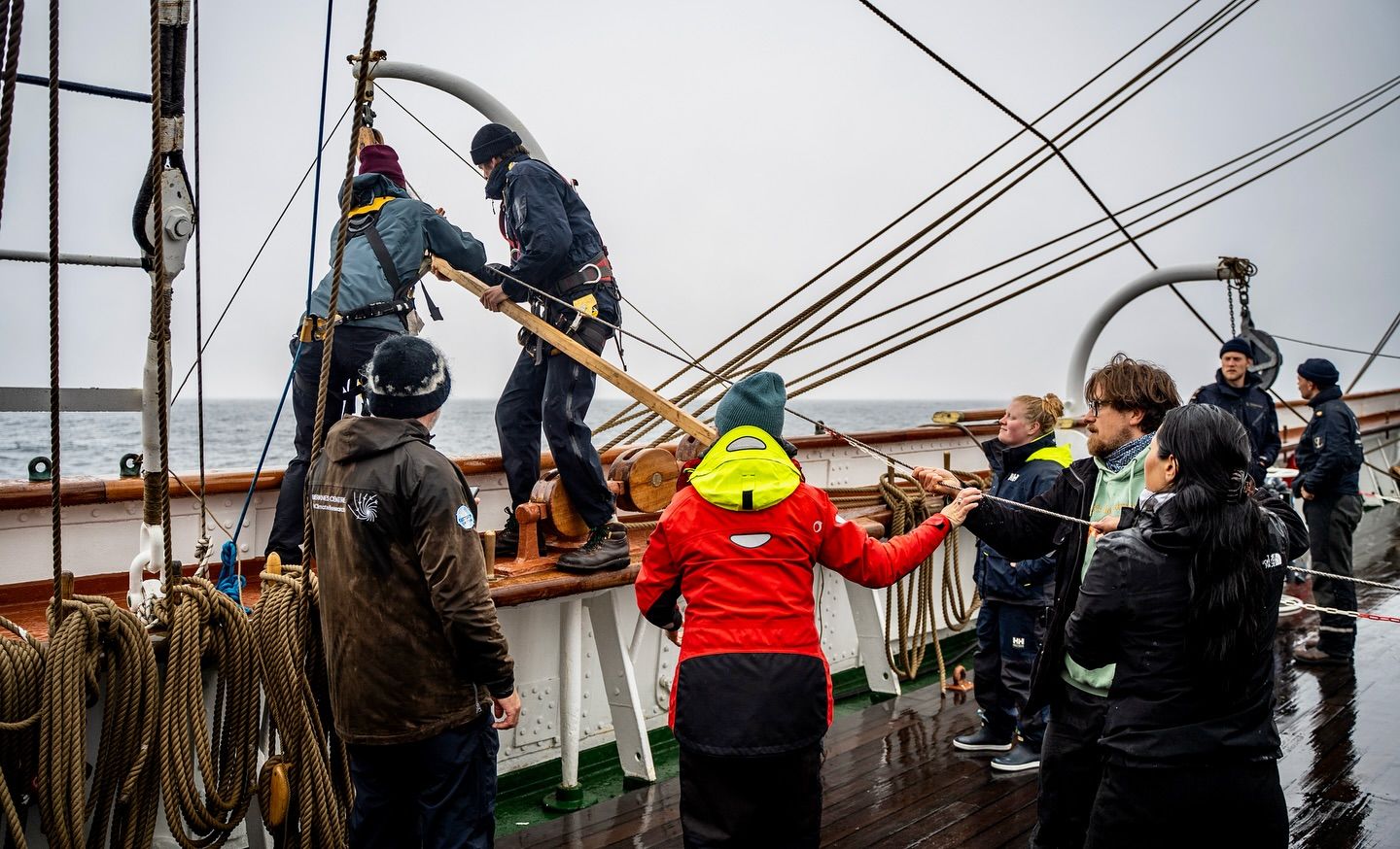
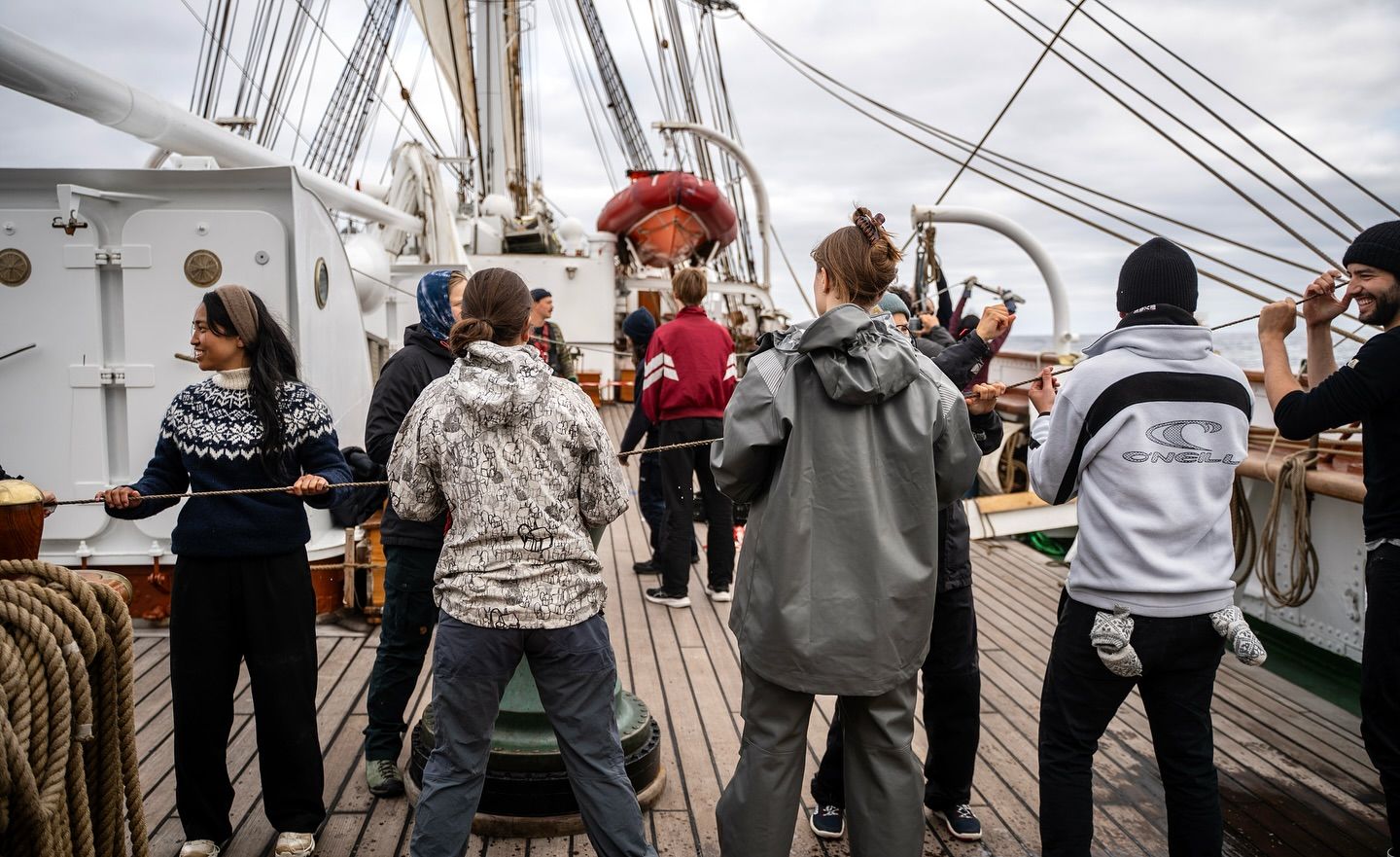
– The students replicated the historical temperature measurements of the Challenger expedition, he explains. They lowered a thermometer on hemp rope, using the same technique employed before modern instruments existed.

To ensure measurement accuracy, the rope was first tested for stretching and shrinking under tension and different moisture conditions. During the measurements, the depth was verified using data from a modern CTD instrument.
Ready for the first measurement. Photo: Malin Kvamme
The thermometer is lowered into the ocean. Photo: Malin Kvamme
The thermometer is lowered into the ocean. Photo: Malin Kvamme
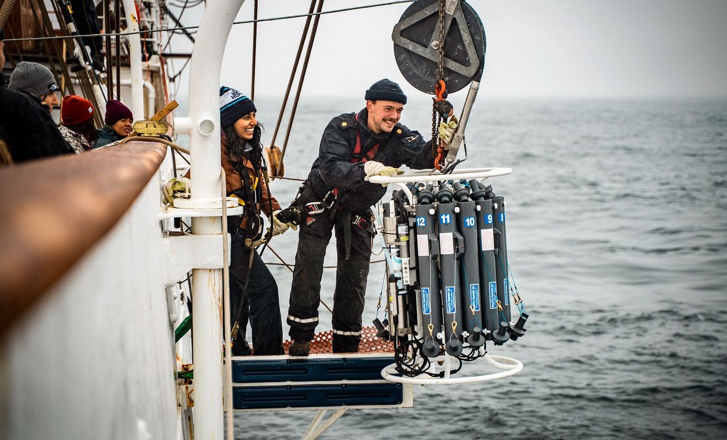
The modern CTD is lowered. Photo: Malin Kvamme
The thermometer is back on deck, and the rope ready for the next measurement. Photo: Malin Kvamme
Calibrate to validate
By aligning the Challenger measurements with precise digital data in this way, Kerim hopes to calibrate the 150-year-old data and thereby validate the long-term time series.
– We are waiting for the final results of the student project, but we found that the modern pressure sensor at the end of the hemp rope measured a depth about ten percent deeper than the number of meters of rope indicated. This means the measurements from HMS Challenger were likely taken at greater depths than the crew thought at the time, Kerim says.
The effect of this may be that the temperatures reported by HMS Challenger were slightly lower than they actually were.
– We do not yet know how significant this difference is, but it could mean that there has been slightly less warming of the deep ocean than we have assumed so far, Kerim concludes.
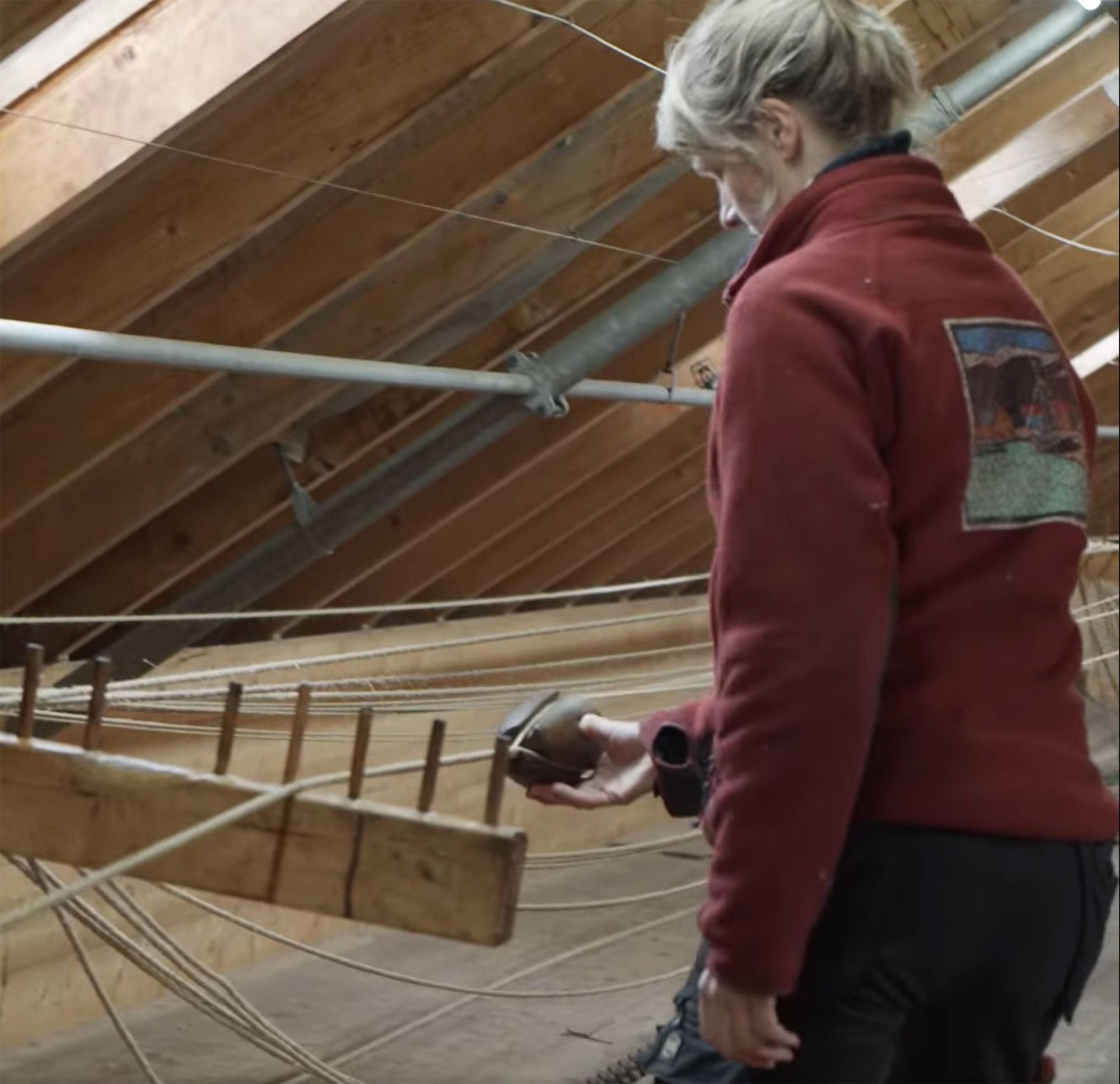
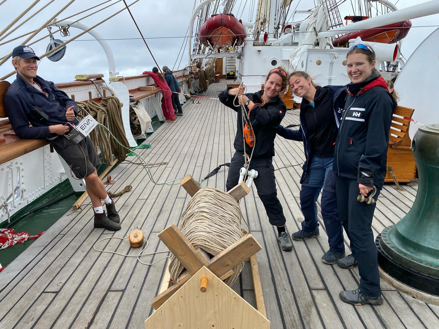
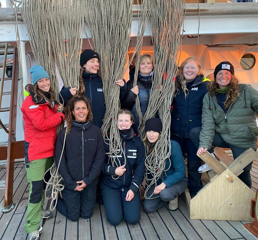
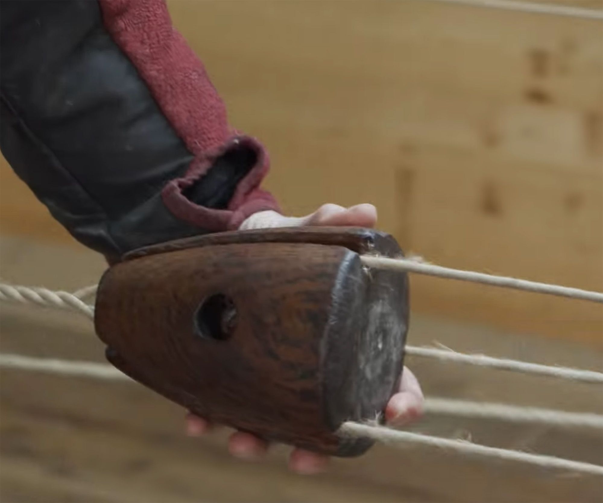
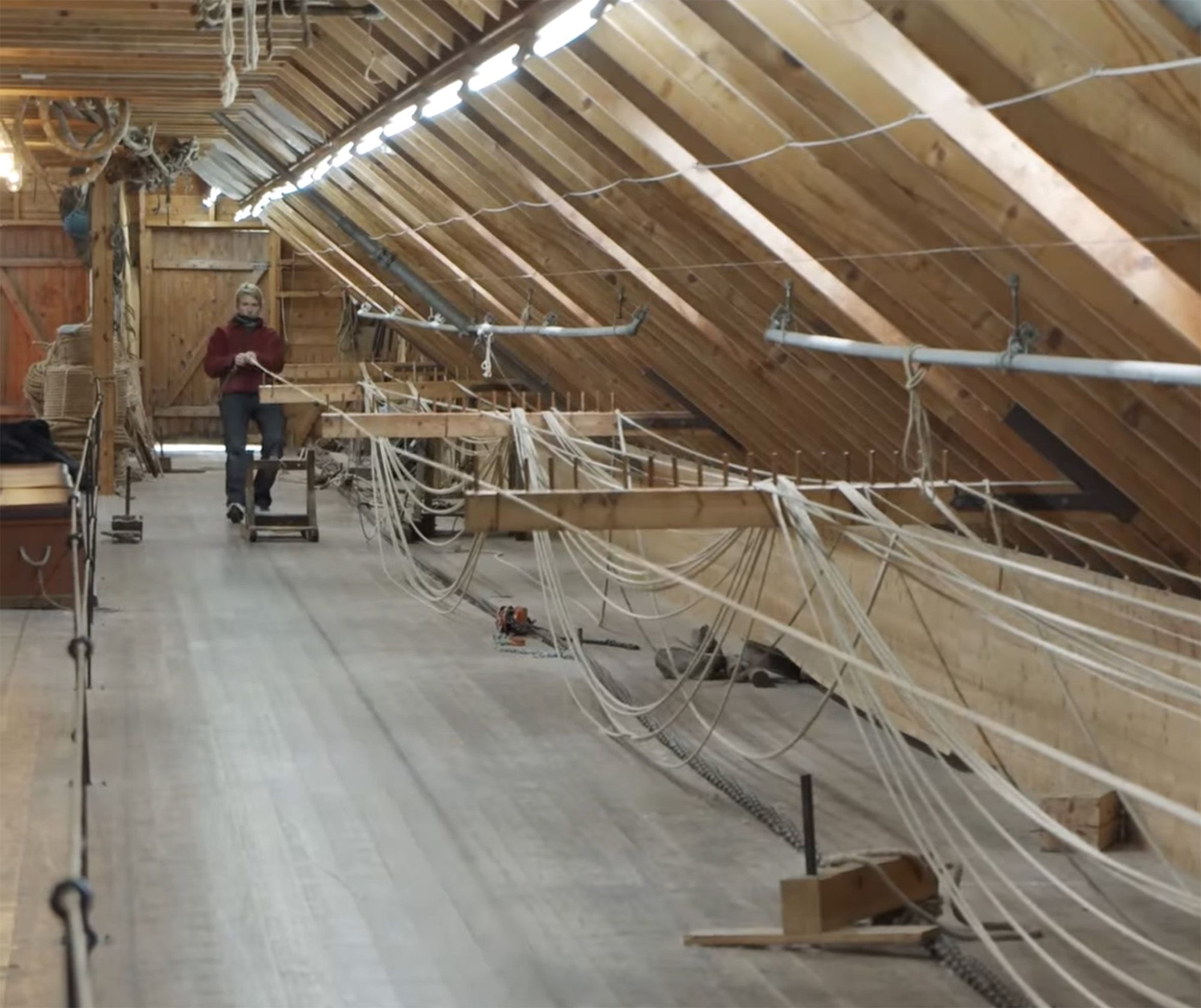
The hemp-rope was produced in the traditional way by Hardanger Fartøyvernsenter in Norway. Photo: Hardanger Fartøyvernsenter
The hemp-rope was produced in the traditional way by Hardanger Fartøyvernsenter in Norway. Photo: Hardanger Fartøyvernsenter
The hemp-rope was produced in the traditional way by Hardanger Fartøyvernsenter in Norway. Photo: Hardanger Fartøyvernsenter